September 25, 2023 – Lifeguards On Duty at 83rd, 95th and 100th Streets
September 25, 2023
The Stone Harbor Beach Patrol has lifeguards on duty today at the beaches at 83rd, 95th and 100th Streets.
September 25, 2023
The Stone Harbor Beach Patrol has lifeguards on duty today at the beaches at 83rd, 95th and 100th Streets.


September 24, 2023
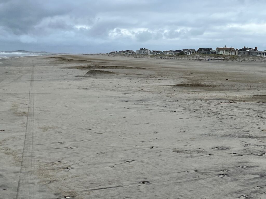
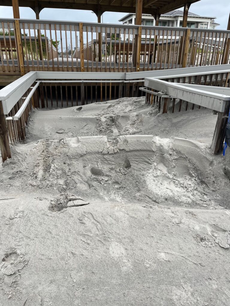
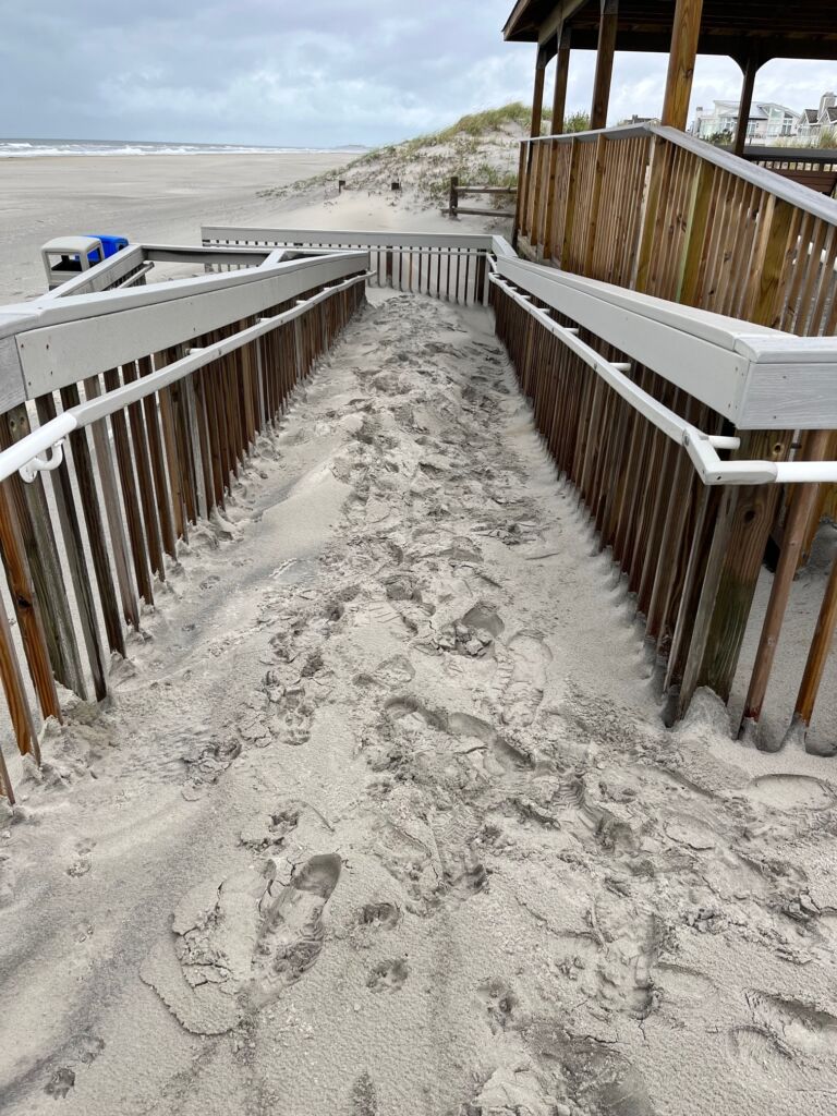
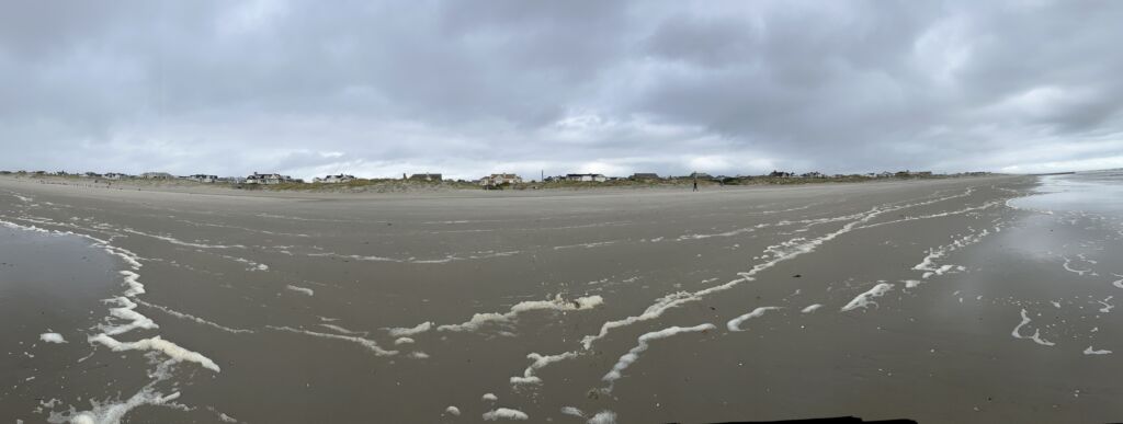
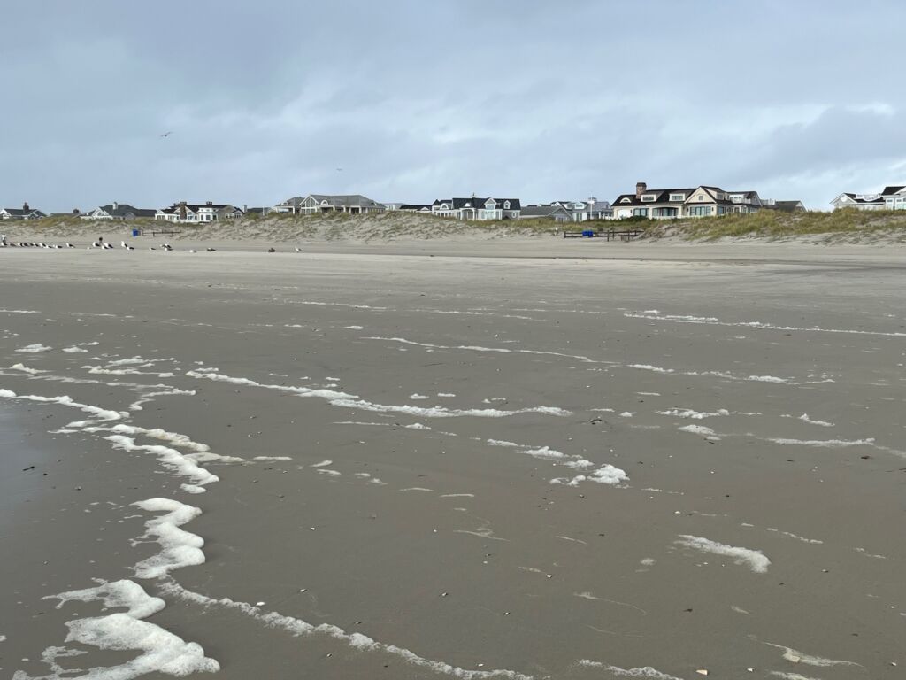
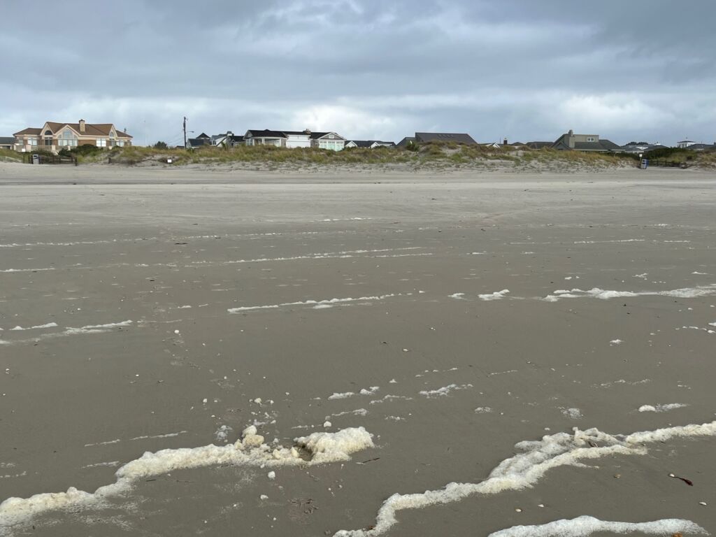
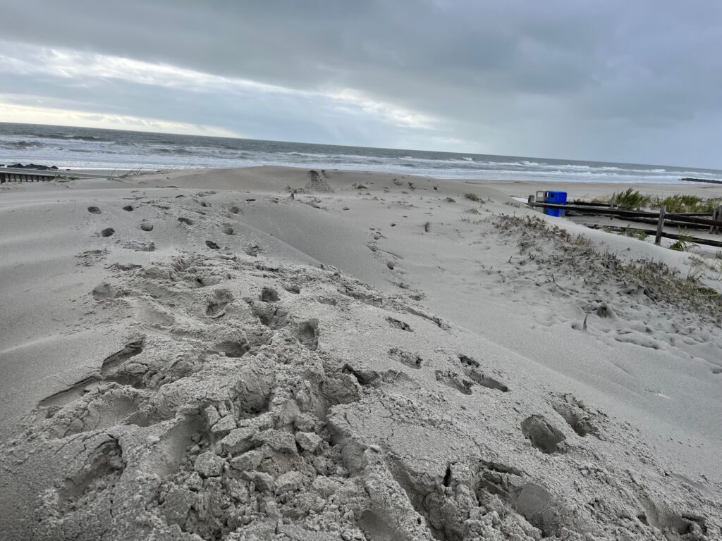
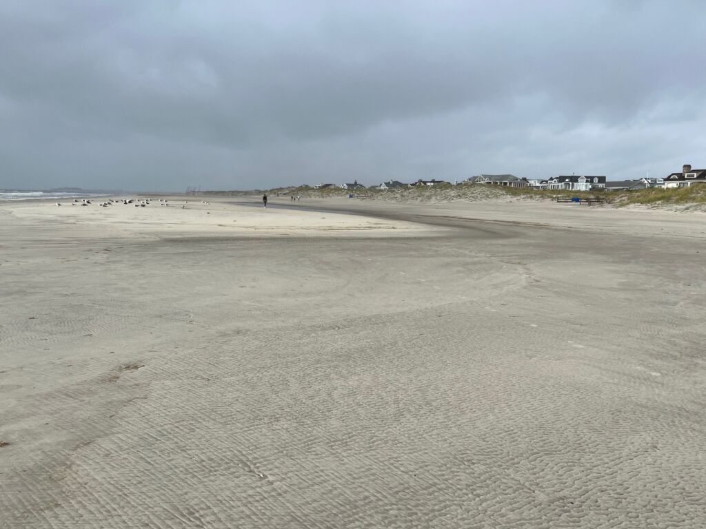
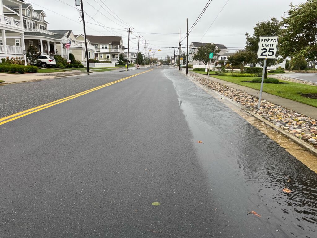
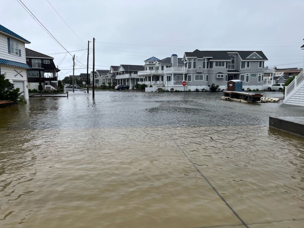
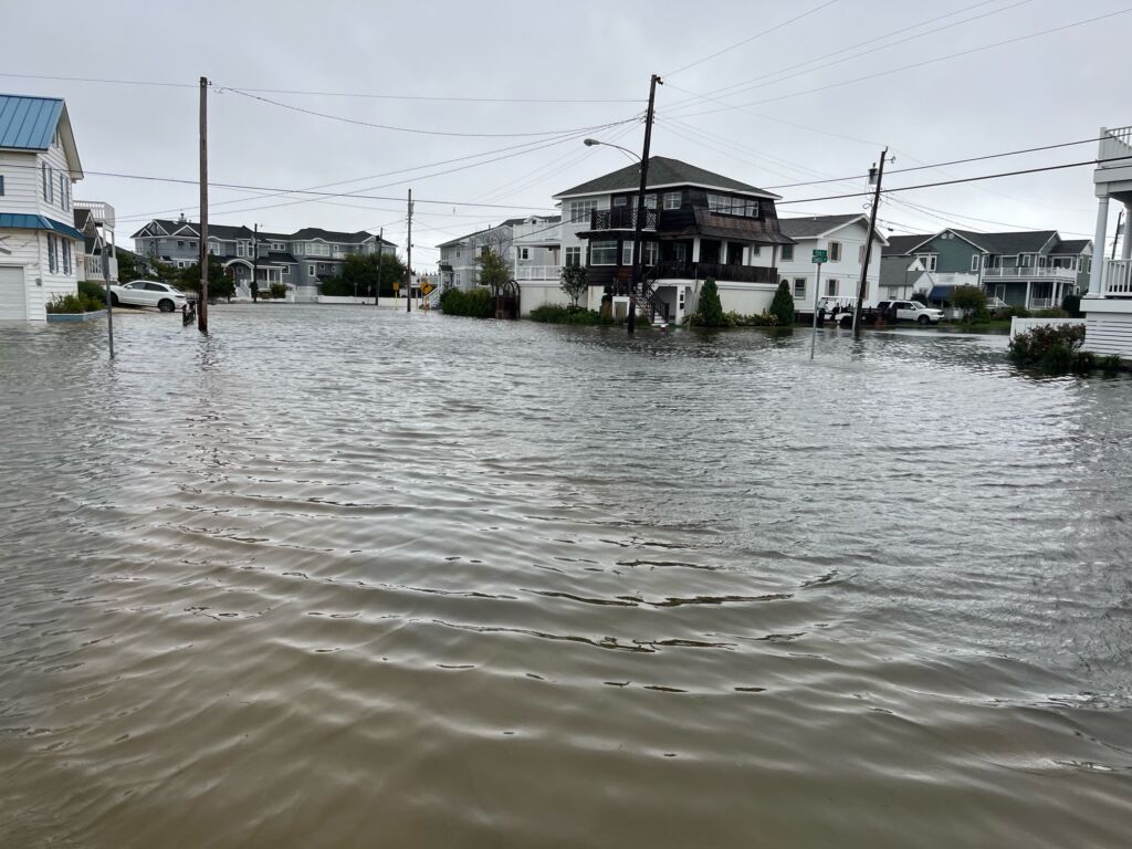
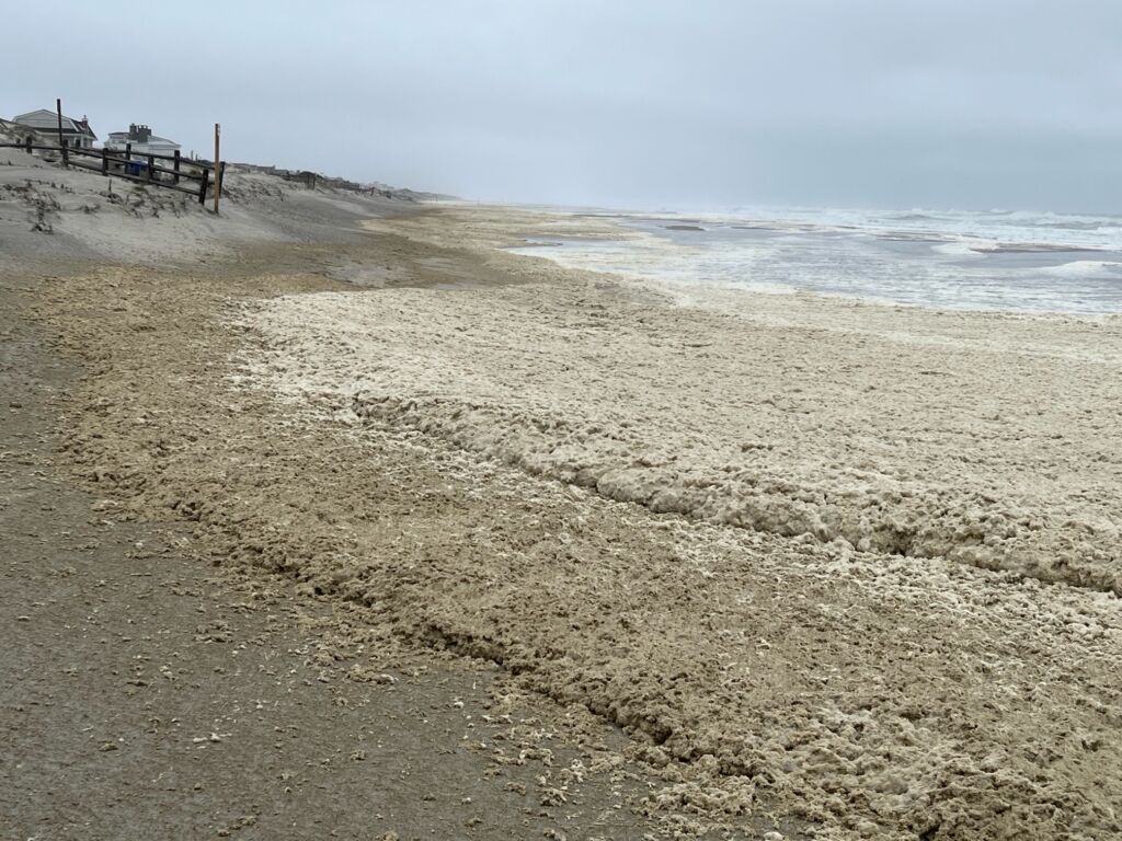
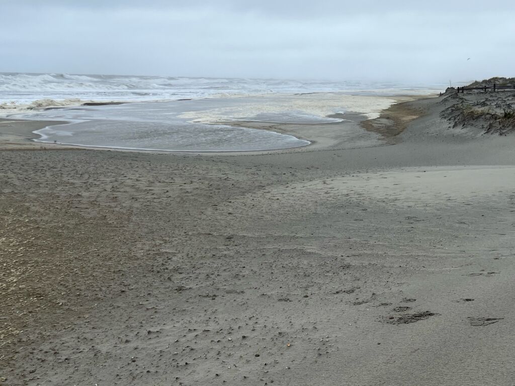
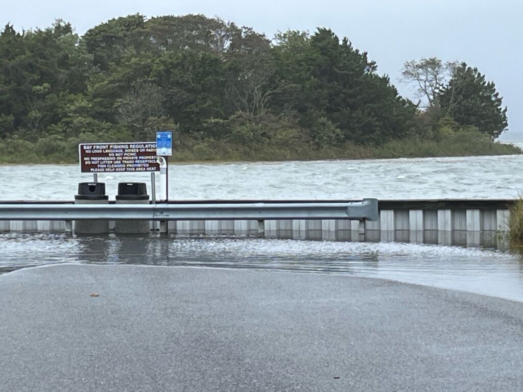
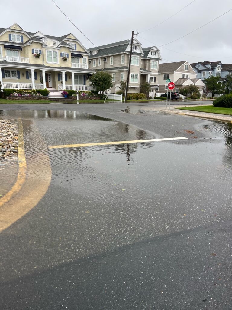
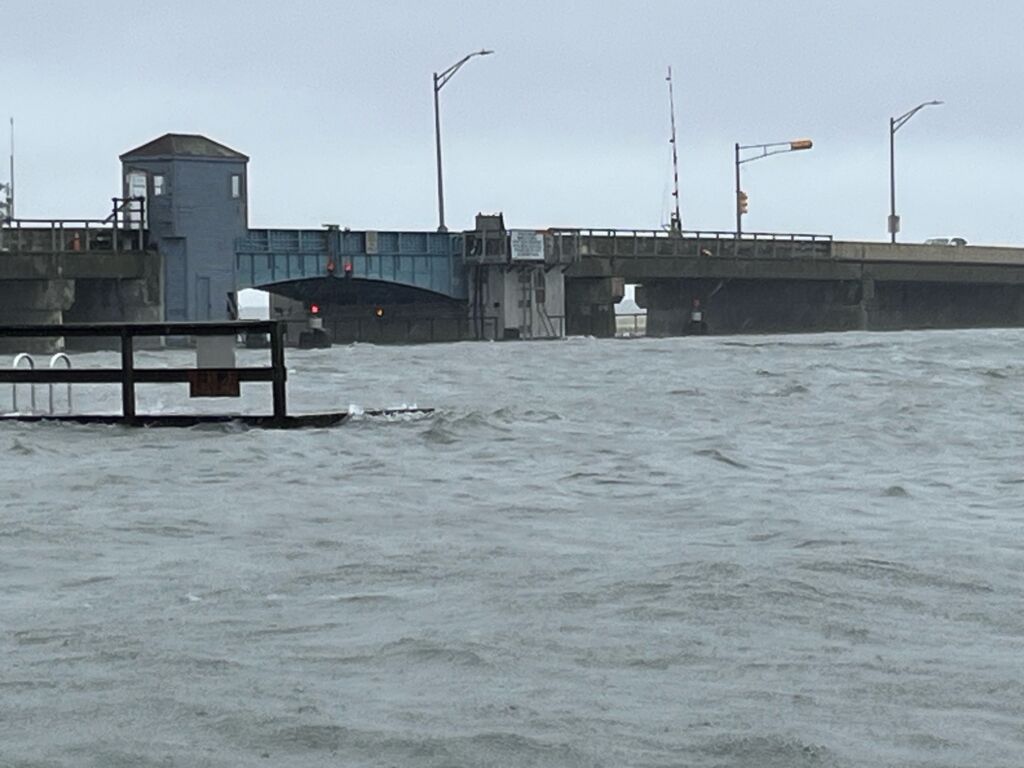
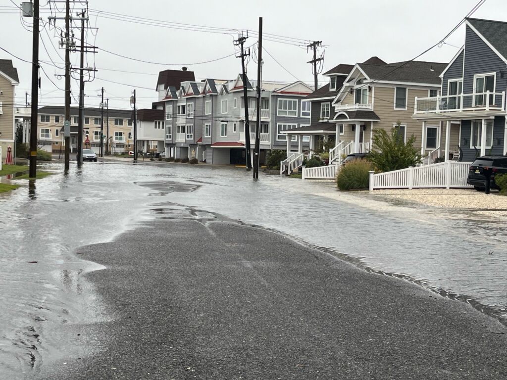
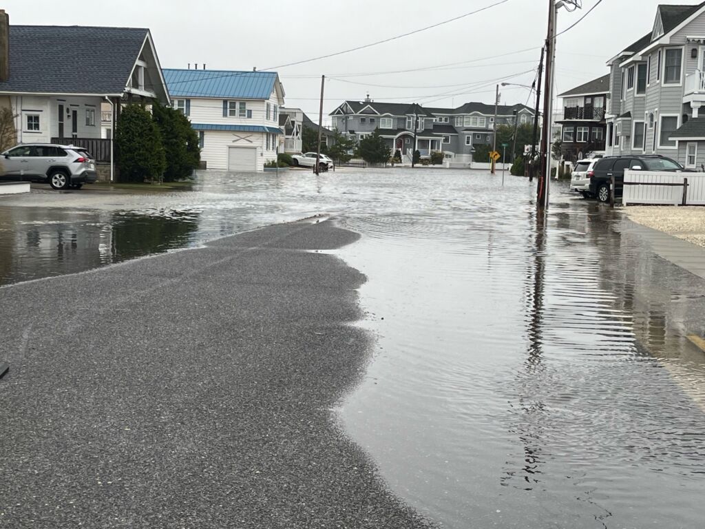
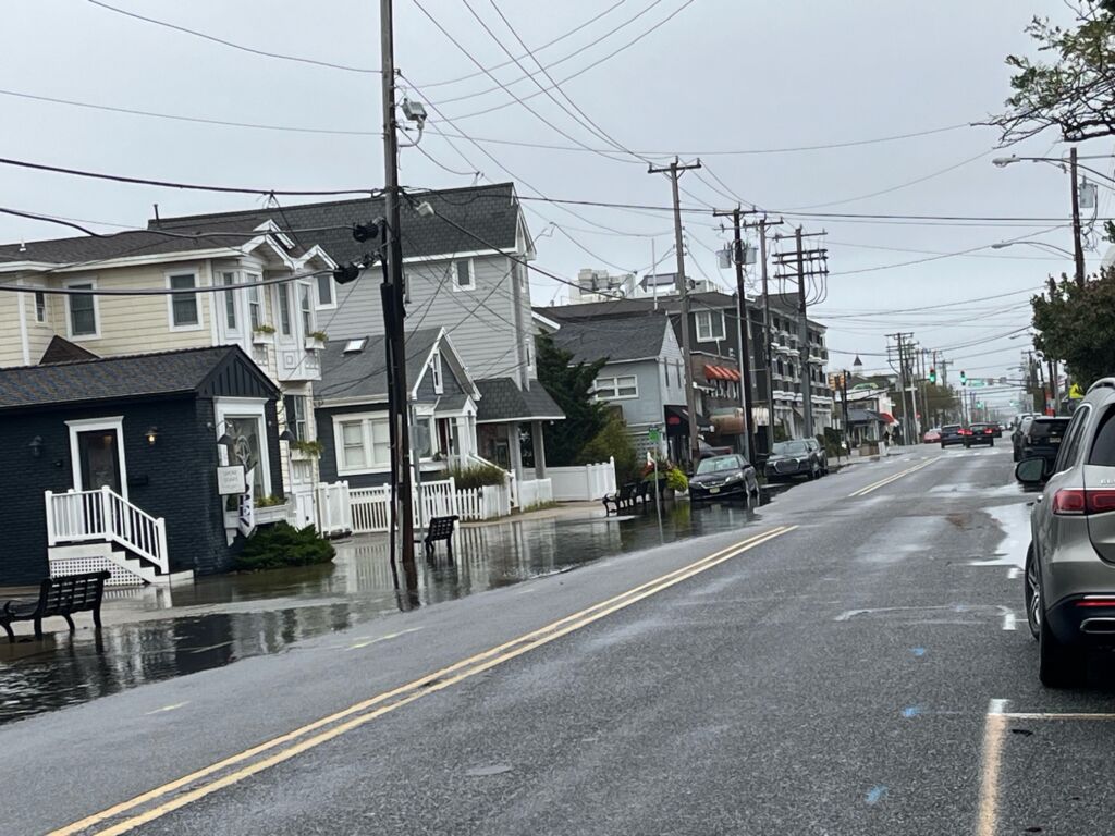
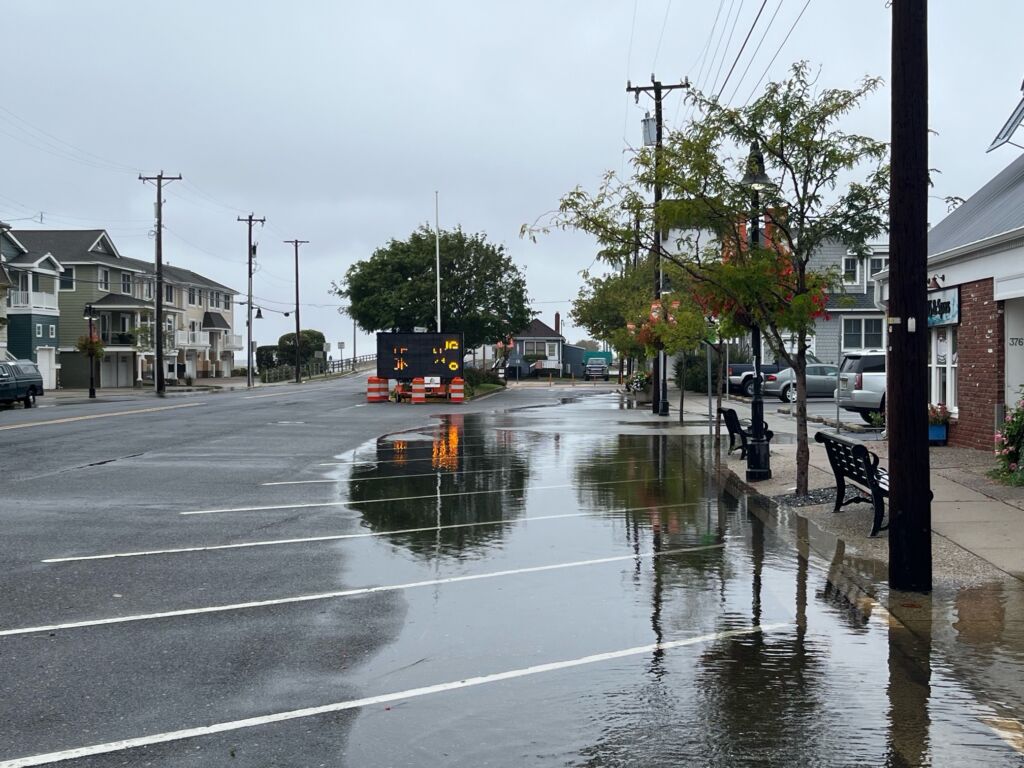
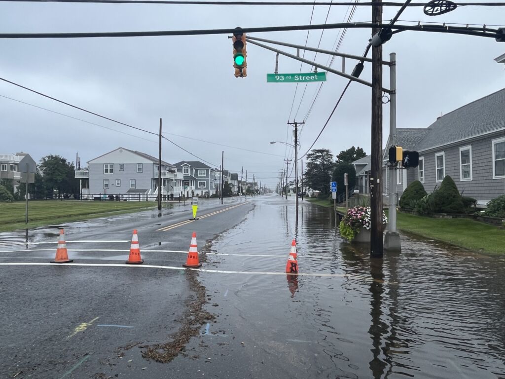
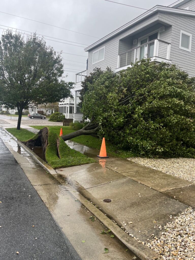
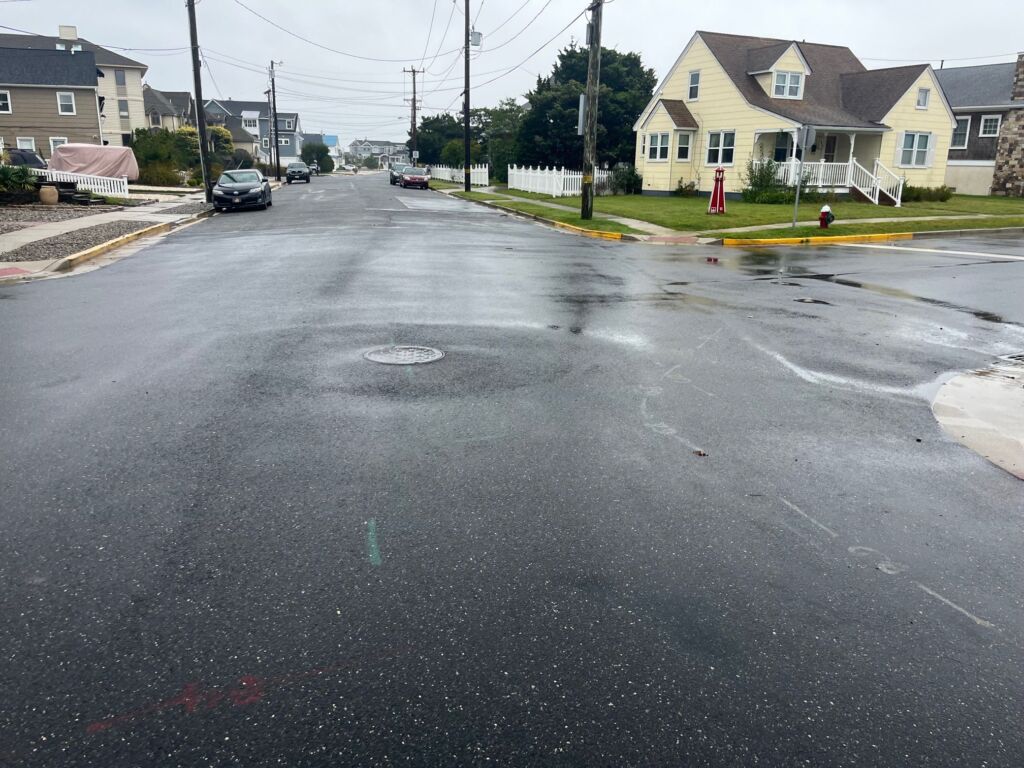
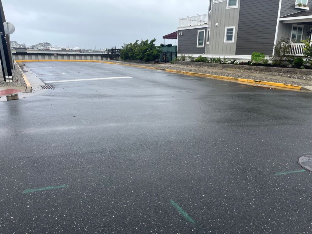
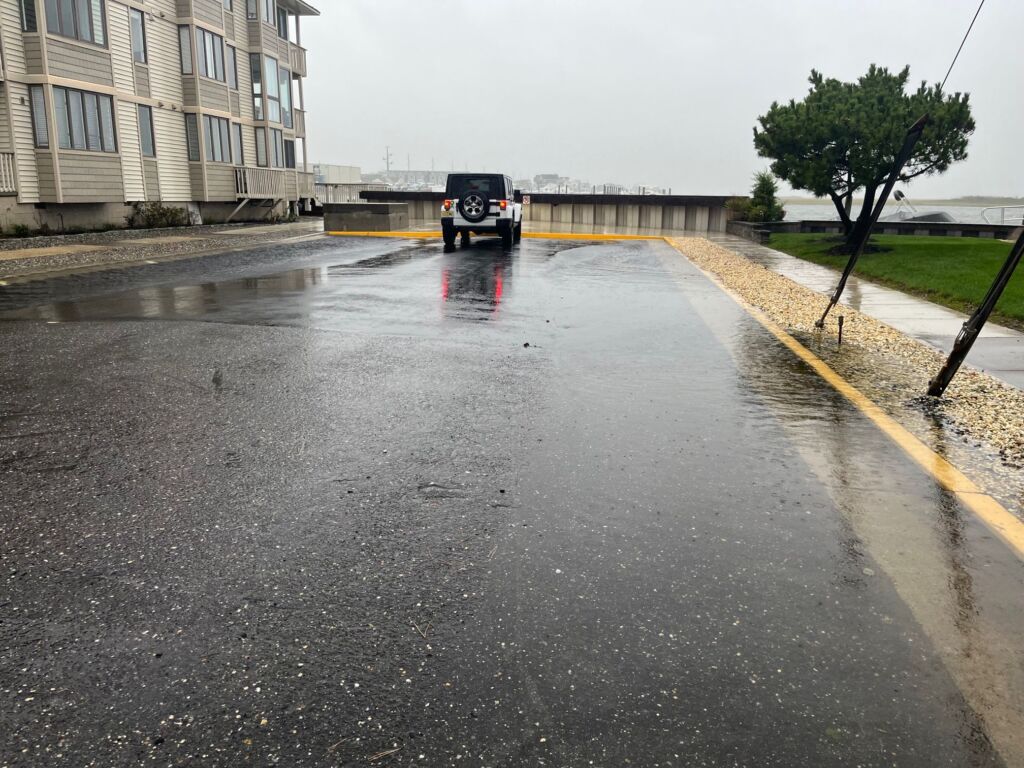
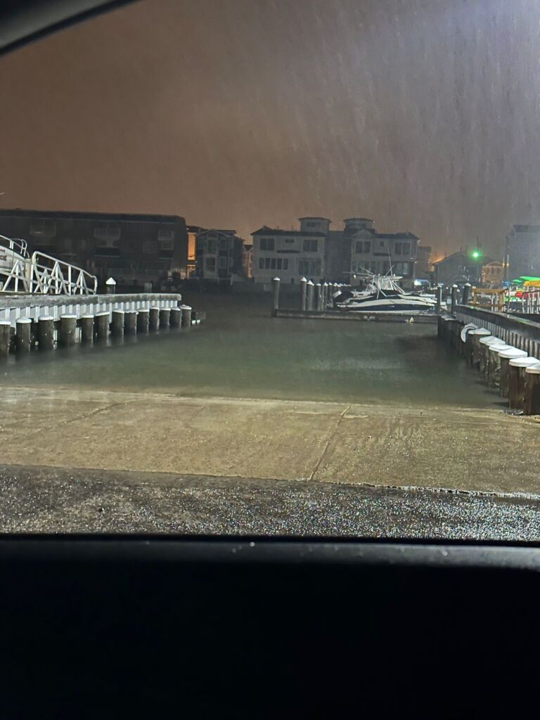
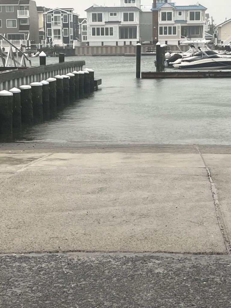
September 23, 2023 – High Tide Photos, approx. 4:00 p.m.
Third Avenue in the low 100s.
93rd Street and Sunset
 93rd
93rd
Street and Sunset
111th Street at Nuns Beach 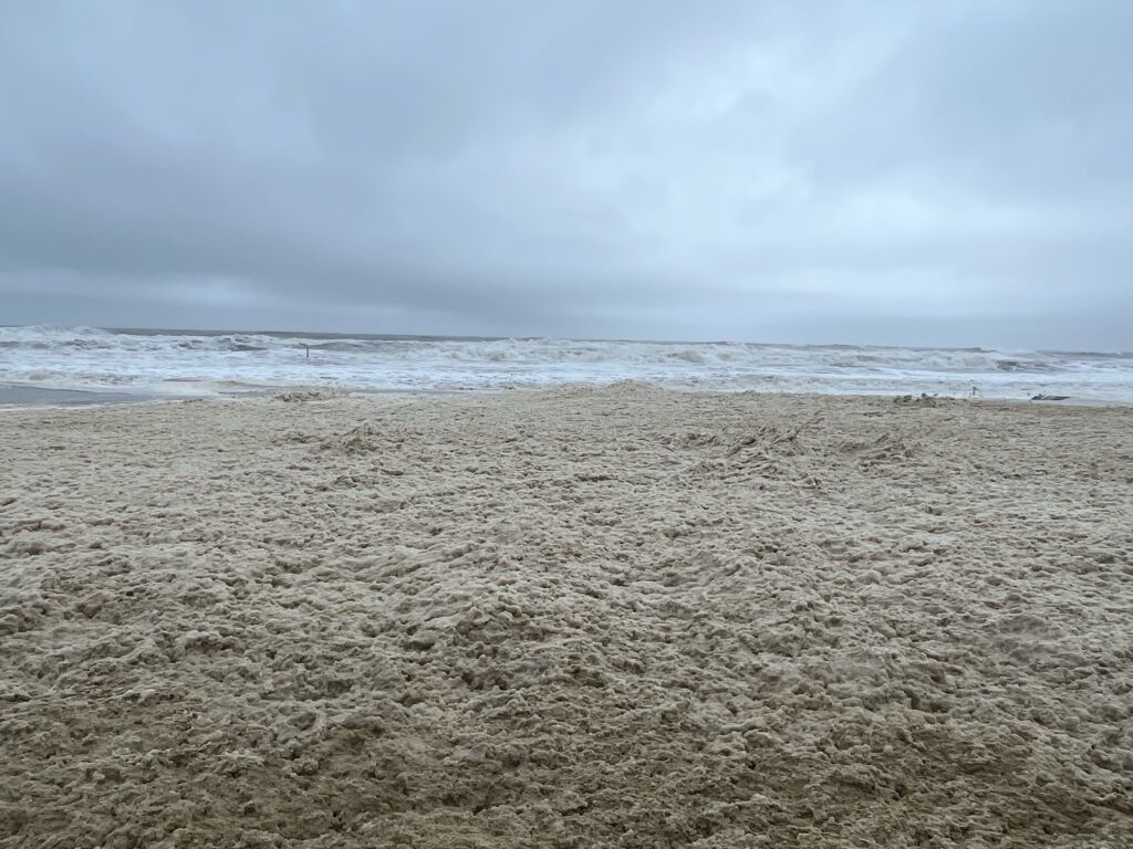
110th at the Bay
103rd and Sunrise
High Tide at the Bay
94th Street and Sunset
98th Street and Third Ave
96th Street near Bridge
93rd Street and Third Ave
September 23, 2023

September 23, 2023
From the National Weather Service:
COASTAL FLOOD WARNING NOW IN EFFECT UNTIL 8 PM EDT THIS EVENING
HIGH SURF ADVISORY REMAINS IN EFFECT UNTIL 4 AM EDT SUNDAY
HIGH RIP CURRENT RISK REMAINS IN EFFECT THROUGH SUNDAY EVENING
* WHAT…For the Coastal Flood Warning, one to two feet of inundation above ground level in low-lying areas near shorelines and tidal waterways. For the High Surf Advisory, large breaking waves of up to 9 feet in the surf zone. For the High Rip Current Risk, dangerous rip currents.
* WHERE…Atlantic Coastal Cape May, Coastal Atlantic and Coastal Ocean.
* WHEN…For the Coastal Flood Warning, until 8 PM EDT this evening. For the High Surf Advisory, until 4 AM EDT Sunday. For the High Rip Current Risk, through Sunday evening.
* IMPACTS…At this level, widespread roadway flooding occurs in coastal and bayside communities and along inland tidal waterways. Many roads become impassable. Some damage to vulnerable structures may begin to occur. Dangerous swimming and surfing conditions and localized beach erosion. Rip currents can sweep even the best swimmers away from shore into deeper water.
* ADDITIONAL DETAILS…With the long duration of onshore winds expected, the back bays may struggle to drain during low tides. This could result in minor to moderate coastal flooding lingering after high tide. Additionally, minor flooding is possible again with the Sunday afternoon high tide.
PRECAUTIONARY/PREPAREDNESS ACTIONS… Take the necessary actions to protect flood-prone property. If travel is required, do not drive around barricades or through water of unknown depth. Inexperienced swimmers should remain out of the water due to dangerous surf conditions. Swim near a lifeguard. If caught in a rip current, relax and float. Don`t swim against the current. If able, swim in a direction following the shoreline. If unable to escape, face the shore and call or wave for help.
September 22, 2023
A message from the Stone Harbor Department of Public Works
Commercial Trash Pick Up Suspended for Sunday, September 24th
Due to the preparation of Public Works staff and resources to respond to Tropical Storm Ophelia, commercial trash and recycling pick up on this Sunday, September 24 is being suspended. Trash and recycling should resume on Monday, depending on the storm clean up required. The solid waste convenience center will also close due to likely flooding on 81st Street and Third Avenue. Please be safe!
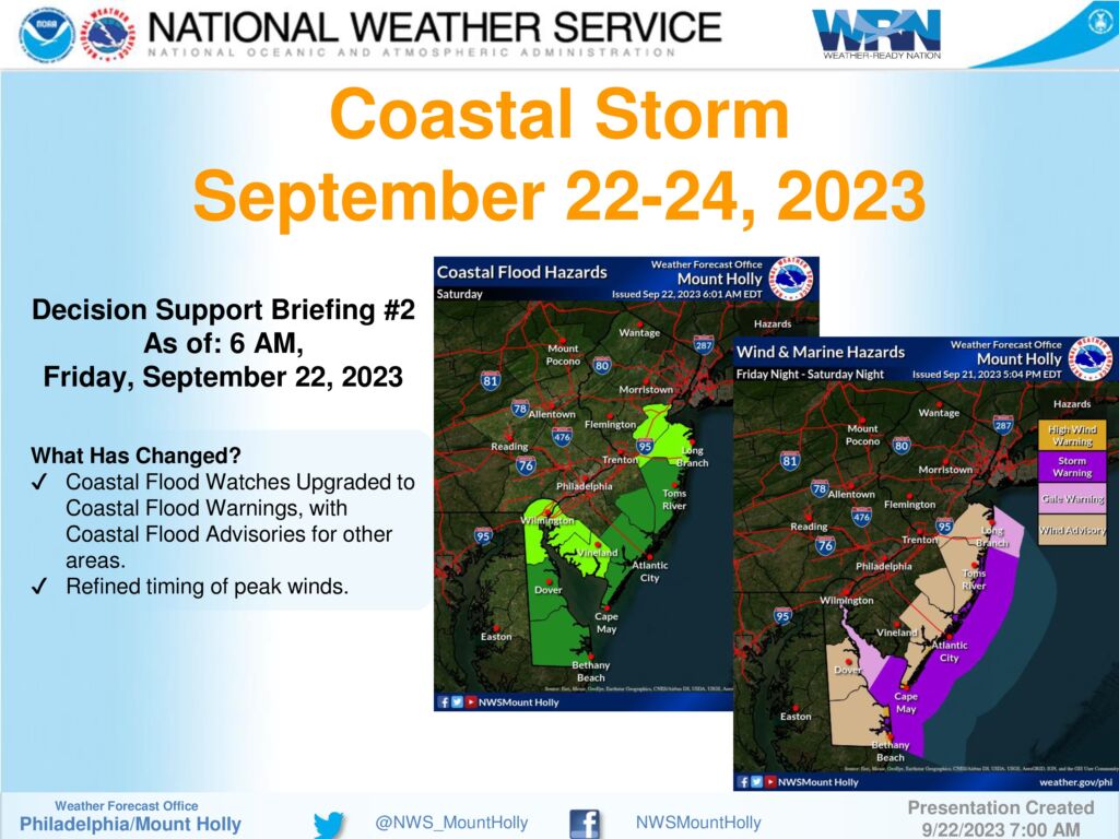
September 22, 2023 – Message from the Cape May County Emergency Management Communications Center
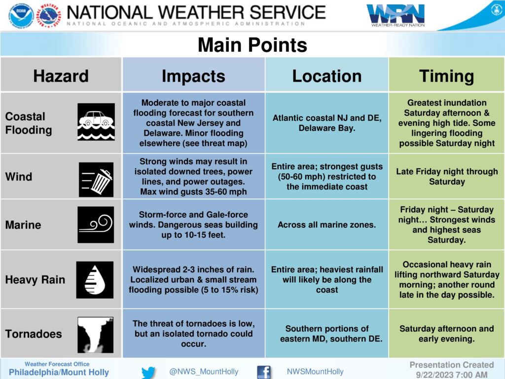
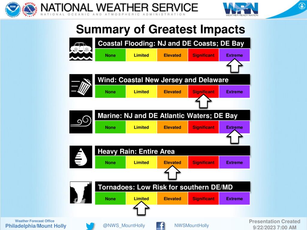
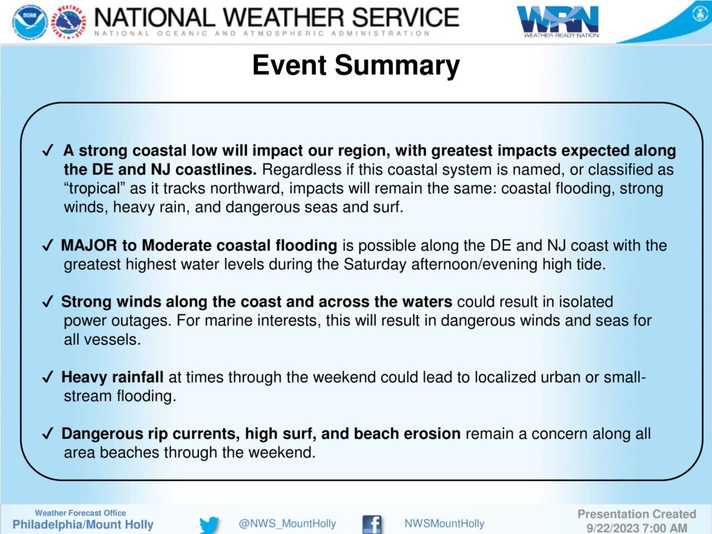
1 – A coastal storm will impact our region this weekend, starting tonight and lasting through Sunday. The most significant impacts will be to areas along the immediate coast on Saturday, in the form of coastal flooding and strong winds, along with periods of heavy rain.
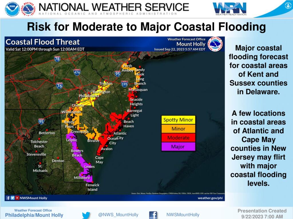
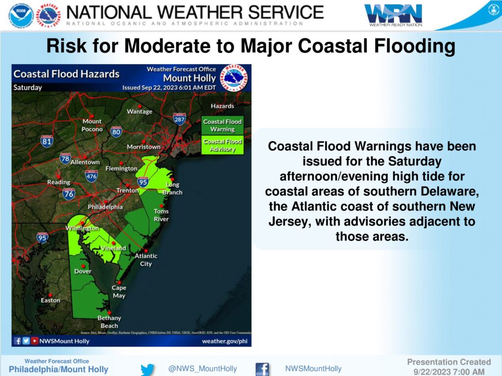
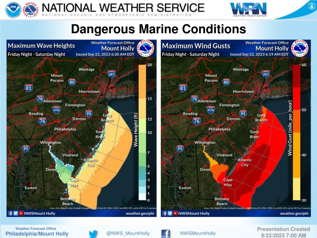
2 – MAJOR coastal flooding is possible along coastal areas of Kent and Sussex Counties in Delaware. Moderate coastal flooding is possible along southern coastal areas of New Jersey; some major coastal flooding cannot be ruled out in spots for Cape May and Atlantic counties in New Jersey. The greatest concern for coastal flooding will likely occur during the Saturday afternoon high tide, around 2-3pm, but could linger into following high tide cycles on Sunday.
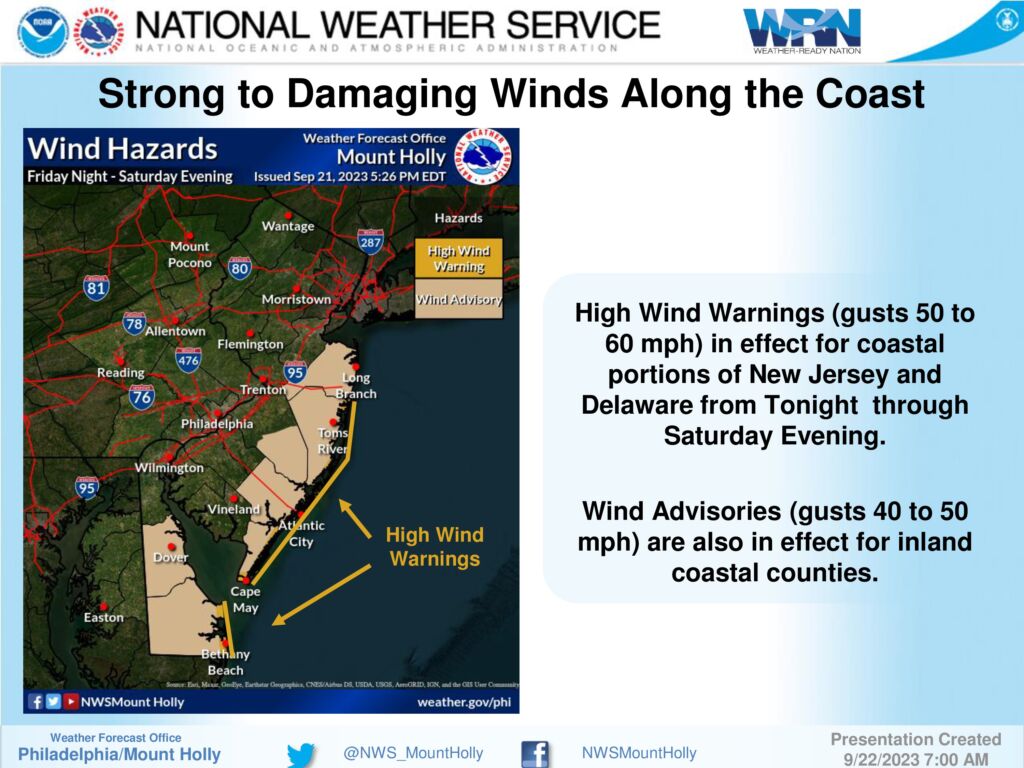
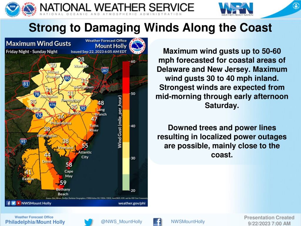
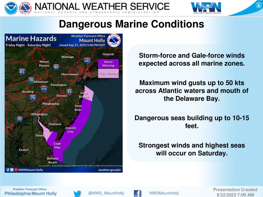
3 – Strong onshore winds are forecast on Saturday. Gusts 50-60 mph are possible across the immediate coastal areas and over the ocean waters; peaking up to 30-40 mph inland. Combined with coastal flooding, this could result in at least minor beach erosion, along with dangerous rip currents. A High Wind Warning has been issued for the coast with Wind Advisories up further inland for all coastal counties of DE and NJ. For our marine zones, dangerous winds and seas have warranted a Storm Warning and Gale Warnings for all waters.
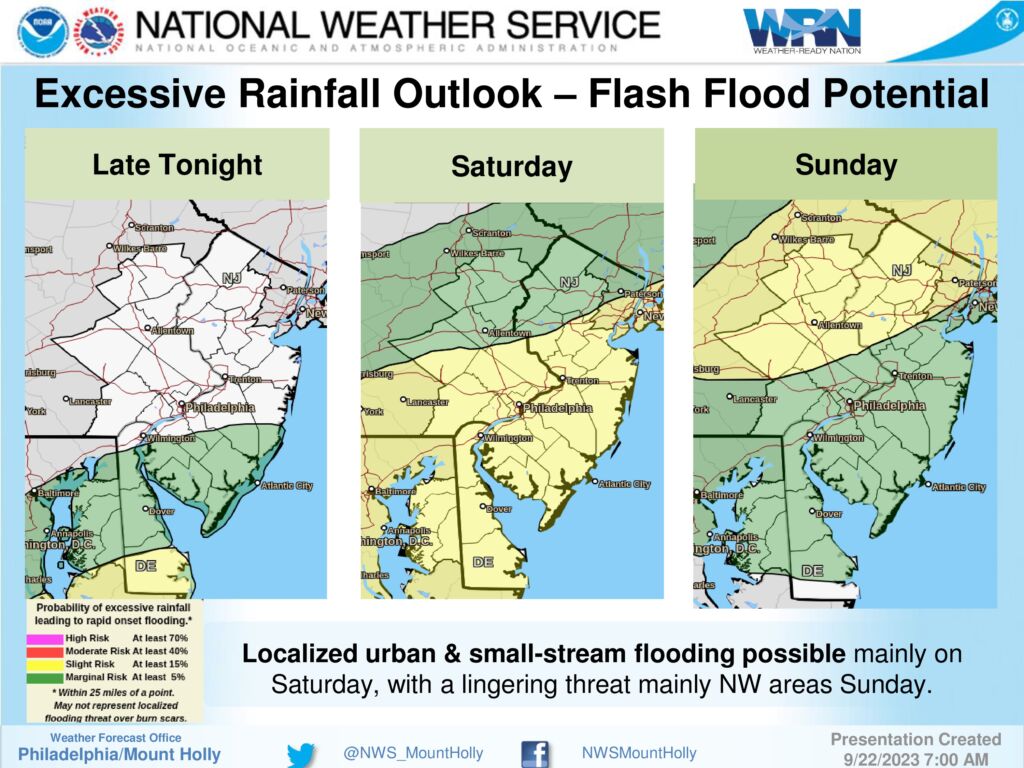
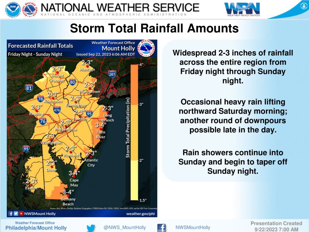
4 – Periods of heavy rain are possible starting late tonight into Saturday morning, with the heaviest periods possible Saturday morning, and again later in the day. 2 to 3 inches of rain may fall across much of the region. However, with most of this falling over an extended period, the threat for flooding should be limited to the localized urban and small-stream variety in poor drainage areas.
Please see the briefing below for the full details.
September 21, 2023
Please note that the Stone Harbor Department of Public Works is currently removing the beach access mats in anticipation of this weekend’s approaching storm and high water. The situation will be evaluated after the storm has passed to determine which, if any, mats will be reinstalled.
September 21, 2023
Lifeguards are on duty today at the following beaches: 83rd, 95th and 108th Streets.
There is a rip current warning in effect.
Statement From the National Weather Service:
HIGH RIP CURRENT RISK NOW IN EFFECT THROUGH FRIDAY EVENING…
* WHAT…Dangerous rip currents expected.
* WHERE…In Delaware, Delaware Beaches. In New Jersey, Eastern Monmouth, Atlantic Coastal Cape May, Coastal Atlantic and Coastal Ocean.
* WHEN…Through Friday evening.
* IMPACTS…Rip currents can sweep even the best swimmers away from shore into deeper water.
PRECAUTIONARY/PREPAREDNESS ACTIONS… Swim near a lifeguard. If caught in a rip current, relax and float. Don`t swim against the current. If able, swim in a direction following the shoreline. If unable to escape, face the shore and call or wave for help.
Borough of Stone Harbor
9508 Second Avenue
Stone Harbor, New Jersey 08247
(609) 368-5102
Borough Hall Office Hours 8:30am to 4:00pm
© Copyright | Borough of Stone Harbor | opens in a new windowJoyceMedia.com

