September 14, 2023 – A message from the Cape May County Emergency Management Communications Center
Here are the key messages for our region in regards to potential impacts from Lee at the end of this week.
1 – Dangerous surf and life-threatening rip currents are already affecting our region. These will only become more severe through the remainder of the week as the storm moves northward in the western Atlantic. They should start to subside by Sunday.
2 – The ocean waters are becoming increasingly hazardous for small craft as seas build, with waves possibly exceeding 10 feet by Friday.
3 – Minor coastal flooding and beach erosion will become a concern as the system makes its closest approach late Friday into Saturday.
4 – Winds over the ocean and adjacent near-shore regions may approach gale force (gusts to near 40 mph) late Friday into Saturday.
5 – At this time we a confident that no additional impacts will occur as the track of Lee is expected to remain well east.
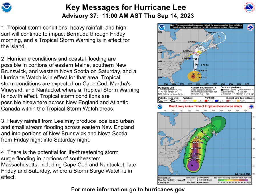
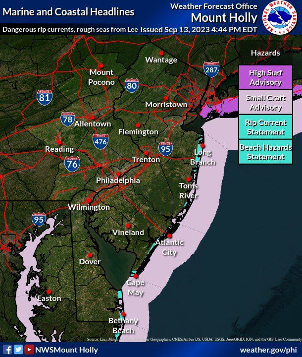
We have also attached the current track forecast and wind speed probabilities as well as a graphic showing current local hazards. For the latest information on the track forecast, visit www.nhc.noaa.gov. For the latest rainfall amount forecast, visit https://www.wpc.ncep.noaa.gov/#page=qpf For the latest local forecast please visit www.weather.gov/phi