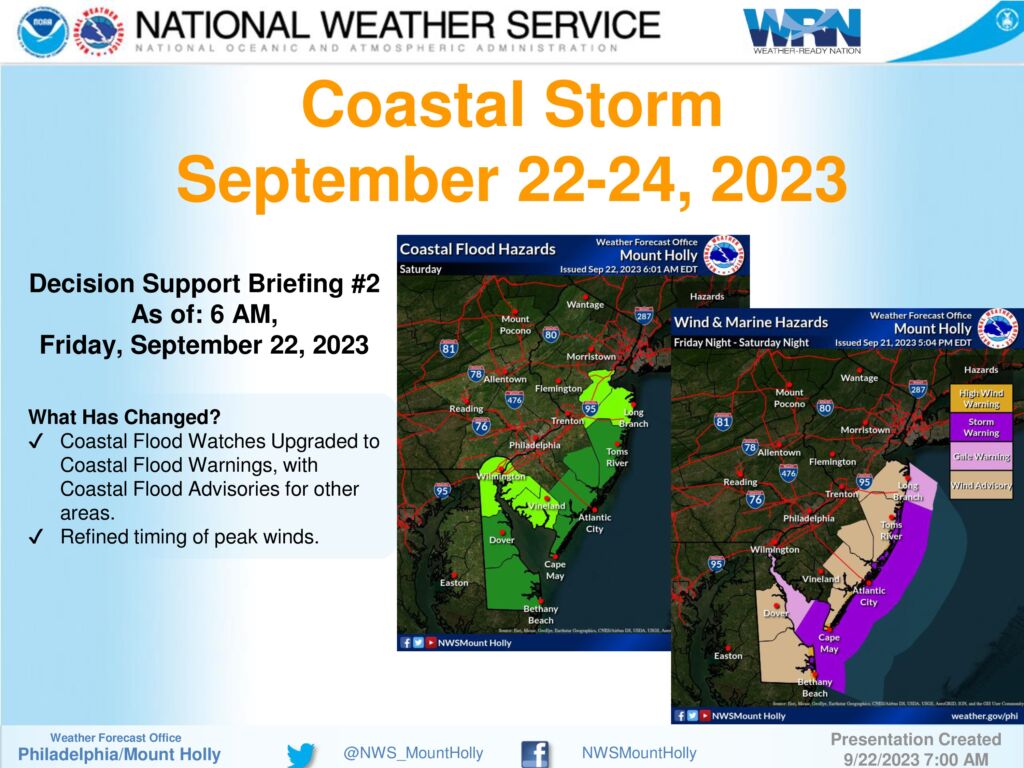
September 22, 2023 – Message from the Cape May County Emergency Management Communications Center
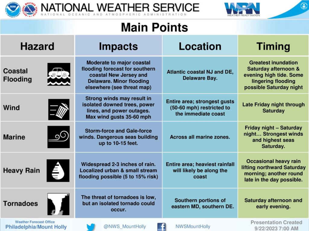
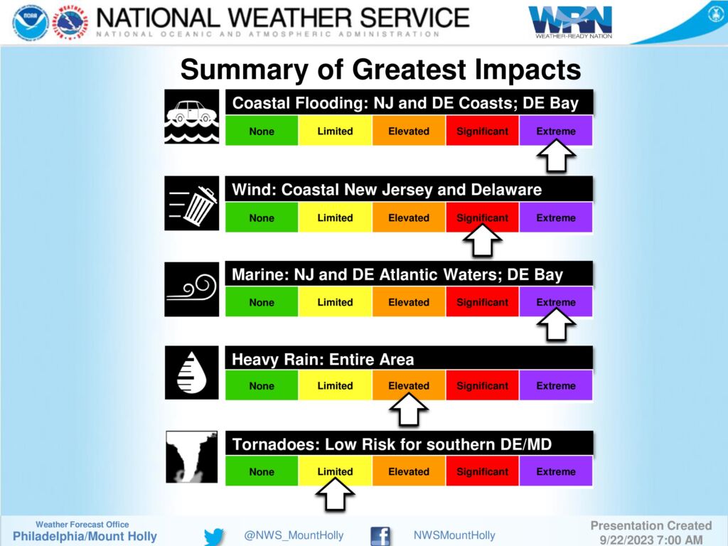
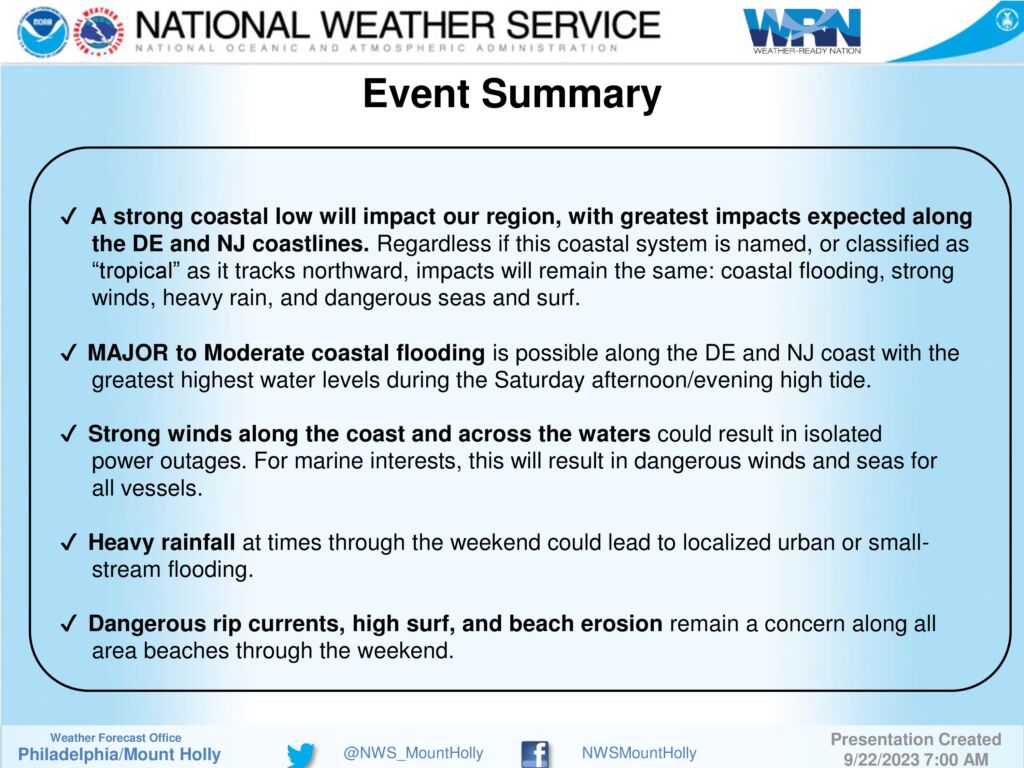
1 – A coastal storm will impact our region this weekend, starting tonight and lasting through Sunday. The most significant impacts will be to areas along the immediate coast on Saturday, in the form of coastal flooding and strong winds, along with periods of heavy rain.
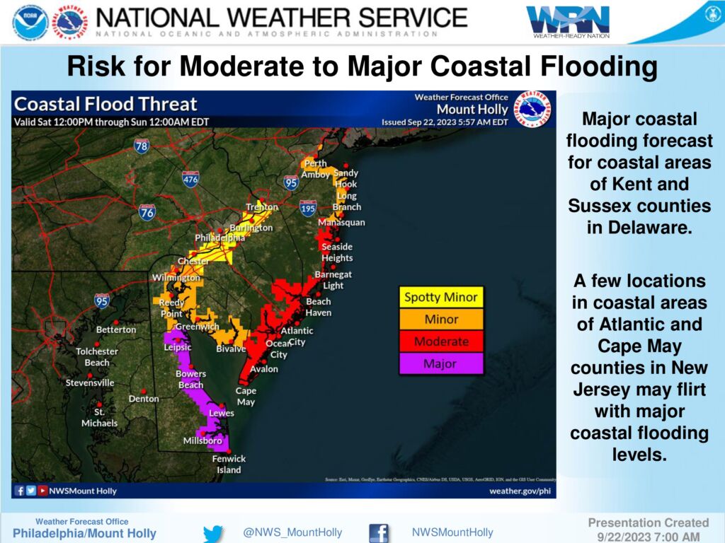
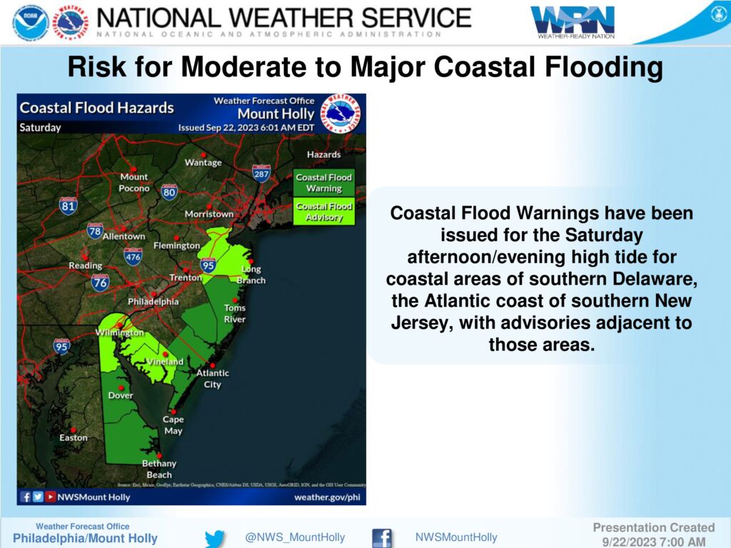
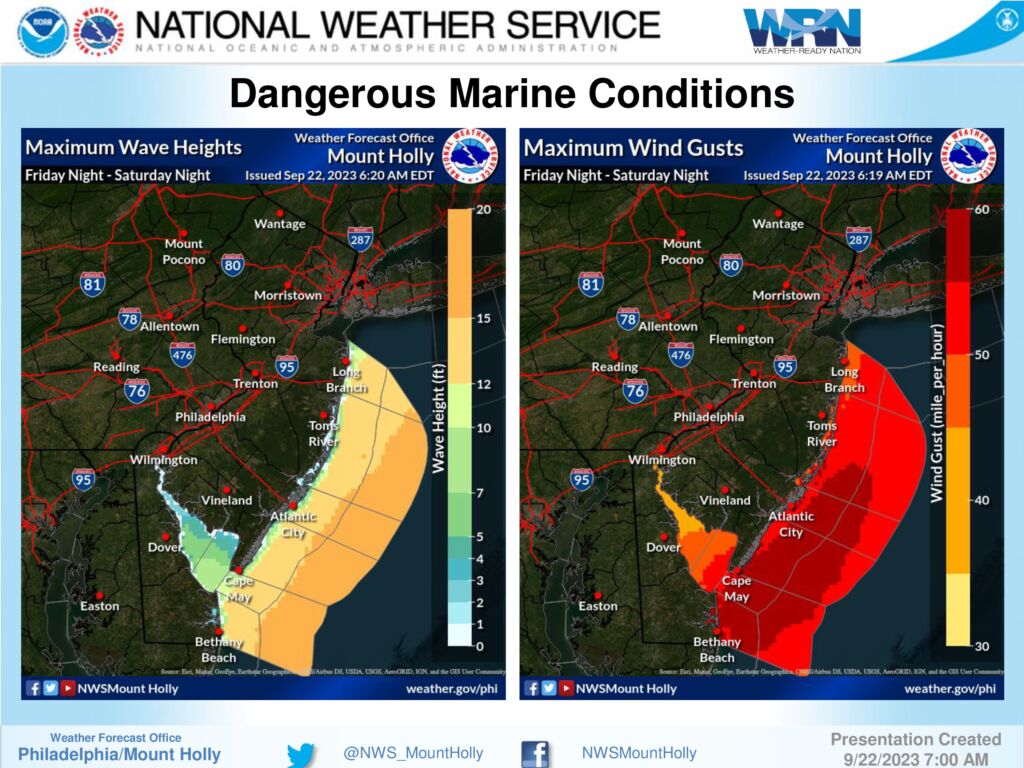
2 – MAJOR coastal flooding is possible along coastal areas of Kent and Sussex Counties in Delaware. Moderate coastal flooding is possible along southern coastal areas of New Jersey; some major coastal flooding cannot be ruled out in spots for Cape May and Atlantic counties in New Jersey. The greatest concern for coastal flooding will likely occur during the Saturday afternoon high tide, around 2-3pm, but could linger into following high tide cycles on Sunday.
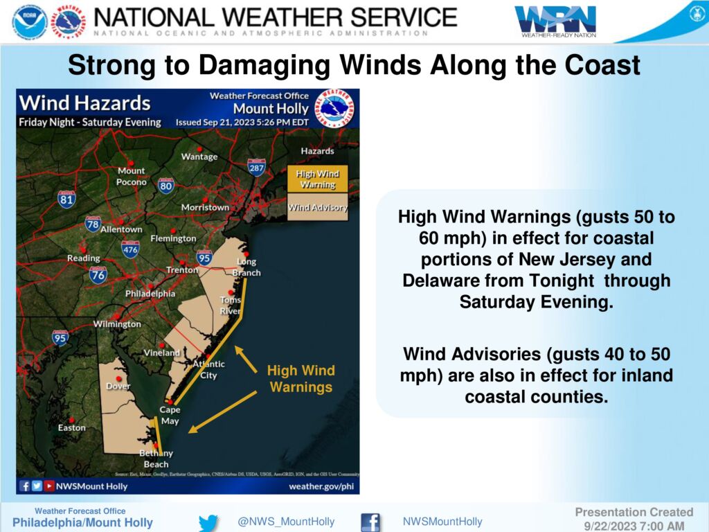
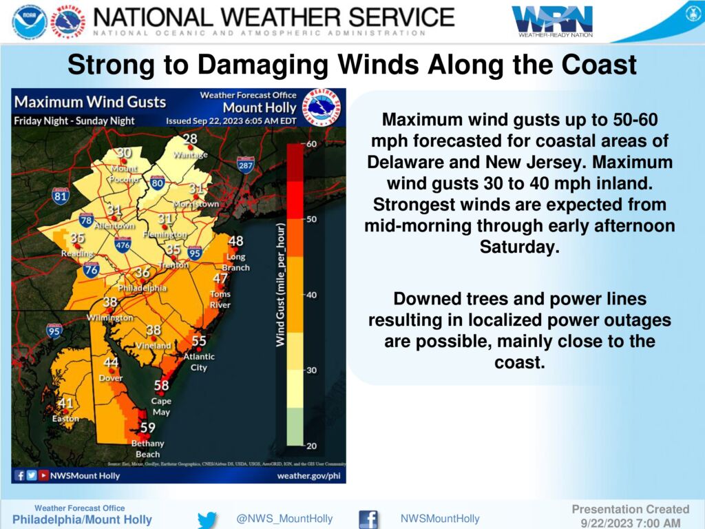
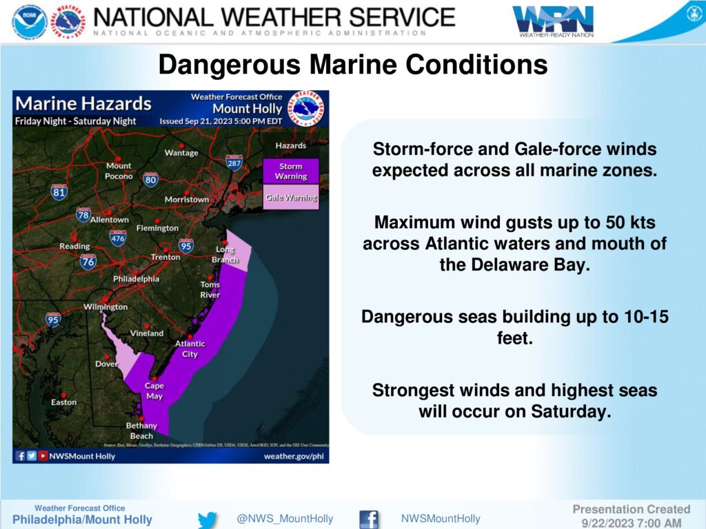
3 – Strong onshore winds are forecast on Saturday. Gusts 50-60 mph are possible across the immediate coastal areas and over the ocean waters; peaking up to 30-40 mph inland. Combined with coastal flooding, this could result in at least minor beach erosion, along with dangerous rip currents. A High Wind Warning has been issued for the coast with Wind Advisories up further inland for all coastal counties of DE and NJ. For our marine zones, dangerous winds and seas have warranted a Storm Warning and Gale Warnings for all waters.
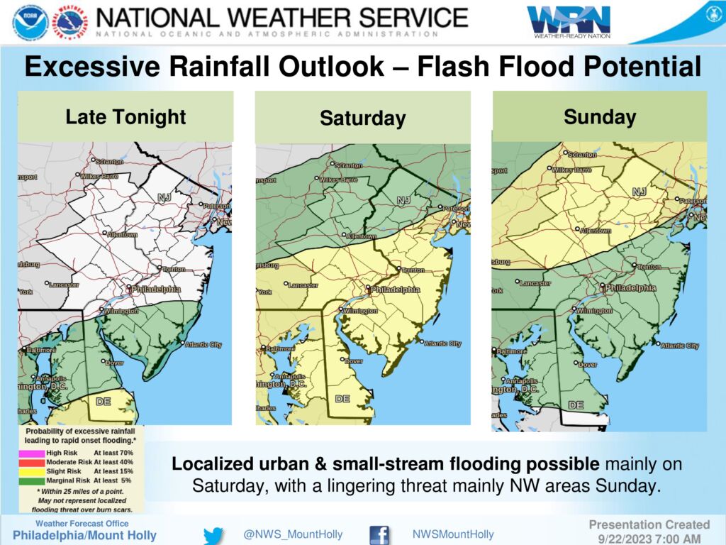
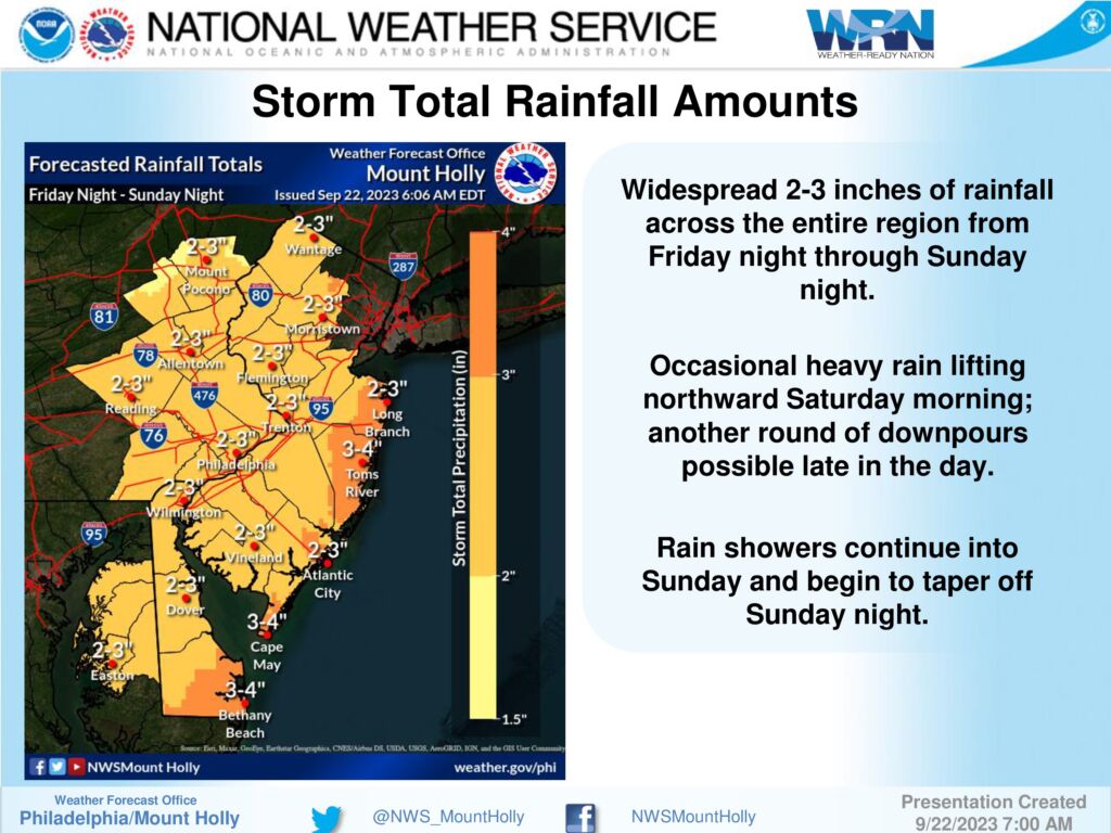
4 – Periods of heavy rain are possible starting late tonight into Saturday morning, with the heaviest periods possible Saturday morning, and again later in the day. 2 to 3 inches of rain may fall across much of the region. However, with most of this falling over an extended period, the threat for flooding should be limited to the localized urban and small-stream variety in poor drainage areas.
Please see the briefing below for the full details.