December 15, 2023
A message from the Cape May County Emergency Management Communications Center
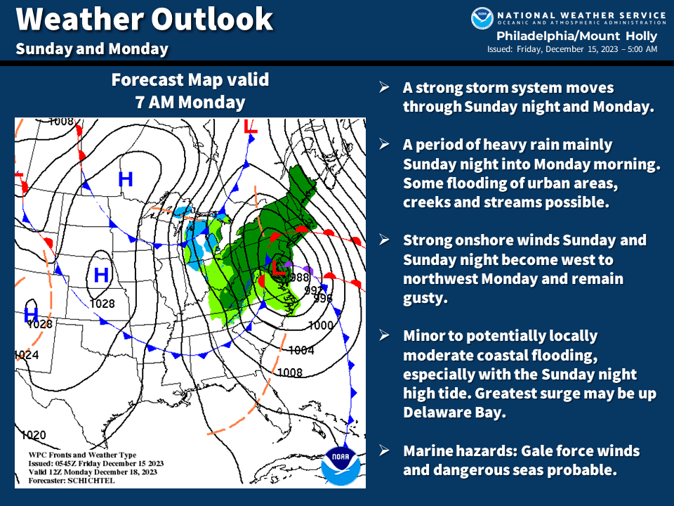
A few changes for the Sunday and Monday storm (December 17th-18th). The risk of flooding has increased some and a Gale Watch has been issued for the marine areas. This storm will impact the Monday morning commute. A summary graphic is below.
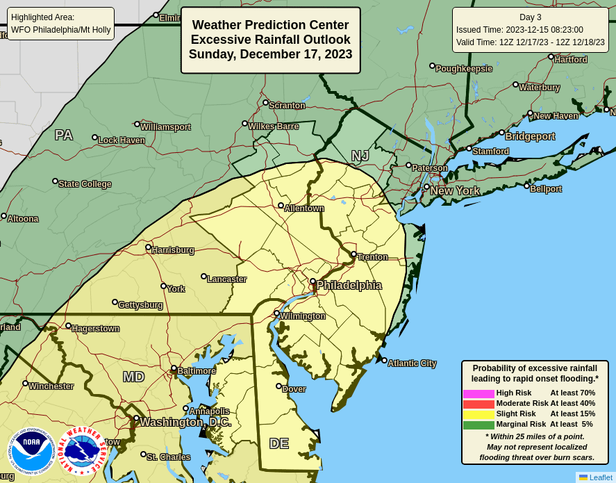
- Heavy Rain: 1.5 to 3.0 inches of rain is probable across the region, which can result in flooding or flash flooding of some creeks and streams and in some urban areas. There is now a SLIGHT risk (level 2/4) for excessive rainfall for much of our region (see attached graphic).
- Winds: East to southeast gusts of 30-40 mph Sunday night into Monday, with gusts up to 50 mph possible mainly along the coast. On the marine areas, a Gale Watch is in effect for Sunday night into early Monday. Dangerous seas are likely. Winds become west to northwest during Monday and remain gusty. Extra precautions may need to be taken with any outdoor holiday decorations up.
- Coastal Flooding: Minor to potentially locally moderate coastal flooding especially with the Sunday night high tide cycle. The greatest surge may be up Delaware Bay due to strong southeast winds Sunday night. The extent/magnitude of the tidal flooding will depend on the strength/duration of the onshore winds and if the greatest surge occurs at high tide.
Confidence is high in this being an all rain event. Confidence remains lower in the specifics and magnitudes of impacts as this depends on the exact track and intensity of the storm.