September 11, 2023
A message from the Cape May County Office of Emergency Management Communications Center.
Here are the key messages for our region in regards to potential impacts from Lee at the end of this week.
1 – Dangerous surf and life-threatening rip currents are the most likely hazard to affect our region. These will likely become significant Tuesday and only become more severe through the remainder of the week as the storm moves northward in the western Atlantic. They should start to subside by Sunday.
2 – The ocean waters will become increasingly hazardous for small craft starting Wednesday as seas build, with waves possibly exceeding 10 feet by Thursday or Friday.
3 – The track of Lee will influence any further impacts across our region, which could include gusty winds and rain if the track shifts further west. At this time, odds of tropical storm conditions anywhere in our region are only 5 percent, but as the storm is still several days away, all interests should closely monitor the progress of the storm.
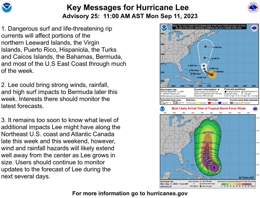
Below is the current track forecast and wind speed probabilities. For the latest information on the track forecast, visit www.nhc.noaa.gov. For the latest rainfall amount forecast, visit https://www.wpc.ncep.noaa.gov/#page=qpf For the latest local forecast please visit www.weather.gov/phi