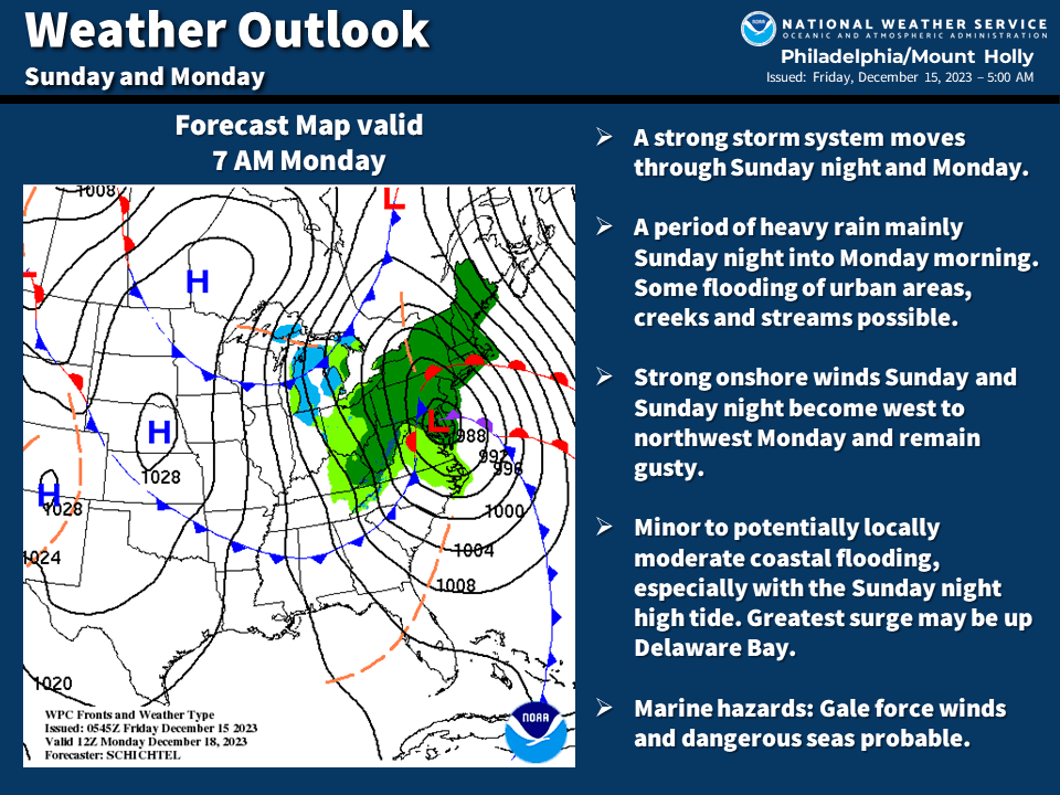
Trash and Recycling Convenience Center is Open Daily
December 20, 2023
Just a reminder that Stone Harbor’s Trash and Recycling Convenience Center is open daily from 7:15 a.m. to 3:15 p.m. The Convenience Center is located on 81st Street, near Third Avenue, adjacent to the Public Works Building. Please note that this location is only for household trash and recyclables, no bulk or brush/yard debris will be accepted.