September 13, 2023 – A message from the Cape May County Emergency Management Communications Center
Here are the key messages for our region in regards to potential impacts from Lee at the end of this week.
1 – Dangerous surf and life-threatening rip currents are already affecting our region. These will only become more severe through the remainder of the week as the storm moves northward in the western Atlantic. They should start to subside by Sunday.
2 – The ocean waters will become increasingly hazardous for small craft starting today as seas build, with waves possibly exceeding 10 feet by Thursday or Friday.
3 – Minor coastal flooding and beach erosion will become a concern as the system makes its closest approach late Friday into Saturday.
4 – Winds over the ocean and adjacent near-shore regions may approach gale force (gusts to near 40 mph) late Friday into Saturday. Gale warnings may be required for the ocean waters.
5 – The track of Lee will influence any further impacts across our region, which could include stronger winds and rain if the track shifts further west. At this time, odds of tropical storm conditions anywhere in our region remain less than 5 percent, but as the storm is still a couple days away, all interests should closely monitor the progress of the storm.
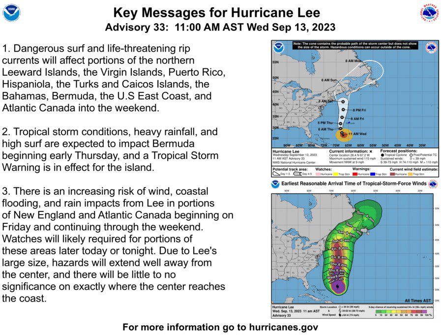
We have also attached the current track forecast and wind speed probabilities. For the latest information on the track forecast, visit opens in a new windowwww.nhc.noaa.gov. For the latest rainfall amount forecast, visit opens in a new windowhttps://www.wpc.ncep.noaa.gov/#page=qpf For the latest local forecast please visit opens in a new windowwww.weather.gov/phi